Mill Record Danbury
RETURN TO ‘FIND MILLS’Disclaimer: Content for these properties was compiled in 2014-2017 from a variety of sources and is subject to change. Updates are occasionally made under Property Information, however the Connecticut Trust for Historic Preservation (dba Preservation Connecticut) makes no representation or warranty that the information is complete or up-to-date.
- Complex Name (Common)
- Danbury Mission Technologies LLC
- Complex Name (Historic)
-
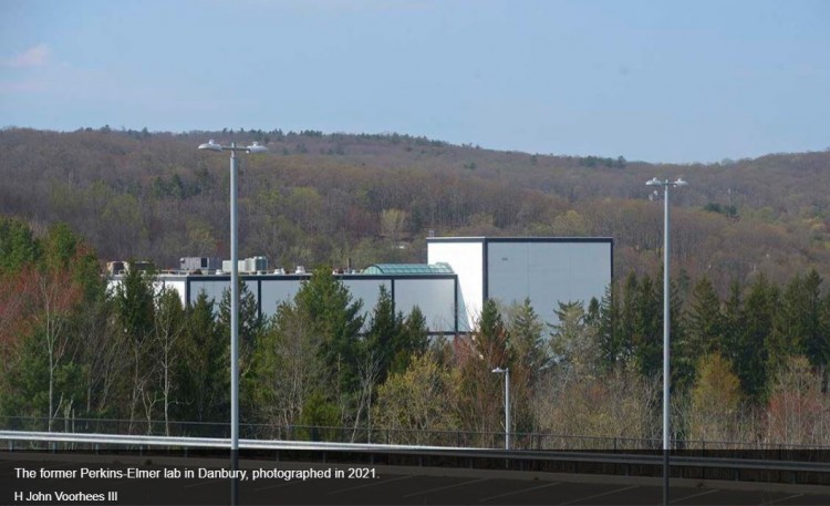
- Perkin-Elmer Laboratory
- Address or Location
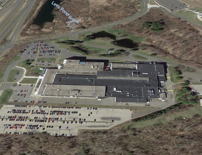
- 100 Wooster Heights, Danbury
- County
- Fairfield
- Historic Designation
-
n/a
- Associated Mill Community
- n/a
")
- Historic Information
Companies Associated w/Complex
- Perkin-Elmer Corp. 1967-1989
- Hughes Danbury Optical Systems (Hughes Aircraft, parent company) 1989-1997
- Raytheon Optical Systems 1997-1998
- The BF Goodrich Co./Goodrich Corp. (parent company) 1998-2020
- Danbury Mission Technologies LLC 2020-present
Use (Historic)
- Clocks, Precision Equipment
- Other: Hexagon spy satellites and Hubble telescopes
Largest Documented Workforce
1000+ (late 1960s-1986)
Historic Narrative
In the mid-1960s, dissatisfied with the resolution of the early Corona and Gambit spy satellites, the federal government (CIA and AIR Force) sought to develop a new satellite which could orbit the earth for months taking high resolution photographs through which information such as missile height could be measured. Perkin-Elmer was awarded the contract, built the lab in Danbury, and made 19 reconnaissance satellites, named Hexagon, between 1971 and 1986. These were strategically important during the cold war, allowing the US to monitor Soviet and Chinese military and economic conditions and compliance with SALT (Strategic Arms Limitation Treaty). The Hexagon's mapping system became the basis for the development of GPS programs widely used today. Hexagon was classified until 2011, and those that worked at the lab were not allowed to disclose what they actually did. During the Hexagon program, NASA created the Hubble Telescope program and contracted Perkin-Elmer to build the telescope's optics. The two programs, one covert, the other open, ran alongside each other at the Danbury facility starting in the mid-1970s. See "The story of the Hexagon..." by Erik Ofgang in the May 2021 issue of Connecticut Magazine (https://www.connecticutmag.com/issues/features/the-story-of-the-hexagon-a-danbury-built-spy-satellite-that-helped-win-the-cold/article_048da0fa-bcb5-11eb-b1e5-fbd23405f7ea.html).
- Architectural Information
Number of Existing Buildings
n/a
Dates of Construction
1967
Architect
n/a
Builder
n/a
Building Type
- Other: Research & development lab
Architectural Description
n/a
Exterior Material(s)
Structural System(s)
Roof Form
Roof Material
Power Source
Condition
n/a
Condition Notes
n/a
- Property Information
-
Specific Location
One 39.59 acre parcel at the SWC of Wooster Heights and route 7.
Adjacent To
Exterior Visible from Public Road?
Yes
Parcel ID / Assessor Record Link
- G18/ / 49 / Link →
Acreage
39.59
Use (Present)
- Sources
-
Form Completed By
n/a
Date
n/a
Bibliography
n/a
- Representative View(s)Click on image to view full file
-


Photographer
n/a
Photography Date
n/a