Mill Record Rocky Hill
RETURN TO ‘FIND MILLS’Disclaimer: Content for these properties was compiled in 2014-2017 from a variety of sources and is subject to change. Updates are occasionally made under Property Information, however the Connecticut Trust for Historic Preservation (dba Preservation Connecticut) makes no representation or warranty that the information is complete or up-to-date.
- Complex Name (Common)
- Dividend Brook Industrial Archaeological District
- Complex Name (Historic)
-
- Dividend Brook Industrial Archaeological District
- Address or Location
- Old Forge Road, Rocky Hill
- County
- Hartford
- Historic Designation
-
n/a
- Associated Mill Community
- n/a
- Historic Information
Use (Historic)
n/a
Largest Documented Workforce
n/a
Historic Narrative
Courtesy Wethersfield Historical Society website (2011) Introduction Wethersfield, Connecticut was settled in 1634 at which time the land areas of Rocky Hill, Newington and Glastonbury were part of the original Wethersfield settlement. The southern or lower end of Wethersfield was first known as Stepney Parish; later it was named Rocky Hill, probably due to the high basalt ridge that is predominant in the area. This small community existed as early as 1676. Rocky Hill was officially incorporated as a town in 1843, while Newington was incorporated in 1871, and Glastonbury separated from Wethersfield in 1693. The following report is a brief history of Rocky Hill’s first industrial park that was located in the southern extremities of the town in an area known as Dividend, which was reached by a road of the same name. When Wethersfield was granting concessions for public use in the 17th century they reserved a strip of land 20 rods wide from Coles Hill on the east side of the burying ground southward to Bulkeley’s Corne Mill site. Later, this narrow strip, part of which was used for a roadway, was divided among adjoining proprietors and some other sections were divided into small lots. Hence, the name Dividend was applied to this section of Rocky Hill. The Rocky Hill citizens were strongly opposed to the Town selling a 68-acre parcel of wetland which was to be included as part of a larger parcel of a proposed industrial, park. They were aware of the historical and environmental significance of this parcel. On December 7, 2004, this 68-acre parcel in the Dividend area of Rocky Hill was set aside as open space in perpetuity following a Town referendum. In April 2006, this area was listed on the State Register of Historic Places and designated an archaeological preserve to be known as “Dividend Brook Industrial Archaeological District.” Dividend is located approximately eight miles south of Hartford in the town of Rocky Hill, Connecticut, adjacent to the Cromwell town line. Dividend Brook, which flows through this property, originates in the western part of Rocky Hill and flows in an easterly direction to the Connecticut River. The brook is a small stream, which meanders through an area called “Pleasant Valley” located between Route 99 (formally, Middletown Road) and the Connecticut River. The hills to the north forming this valley have been leveled for development. The hills to the south are presently being mined for sand and gravel. The northern slope of these hills which border Dividend Brook have been left partially intact. There are two natural waterfalls along this stretch of the brook. It is along this section of Dividend Brook that Rocky Hill’s first industrial park began. It grew and flourished until the early 20th century when all industry here finally ceased. In 1661, 27 years after the settling of Wethersfield, the Town made a concession to Governor Winthrop of 140 acres conditional on his erecting a corne mill (gristmill) there. He failed to do so, and in 1668 he released the property back to the Town of Wethersfield. In 1665 the Reverend Gershom Bulkeley, minister of the First Congregational Church in Wethersfield, expressed, to the Town officials, an interest in building a gristmill. In 1667 the town of Wethersfield granted to Rev. Bulkeley 115 score acres together with Mr. Stone, the Reverend’s assistant. Mr. Stone received 100 acres and 110 acres went to Rev. Bulkeley. Rev. Bulkeley’s acreage extended all the way to the Connecticut River. At the most easterly waterfall on Dividend Brook, where the Connecticut Valley Railroad now spans the stream, is the site where Rev. Bulkeley built his gristmill in 1667. The town of Wethersfield gave him permission to flood as much of the town land as he needed to produce sufficient waterpower to operate his mill. This mill pond later became known as 'Lower Dividend Pond.' Later, Rev. Bulkeley was granted an additional 150 acres towards the west. He then reloc
- Architectural Information
Number of Existing Buildings
n/a
Dates of Construction
n/a
Architect
n/a
Builder
n/a
Building Type
Architectural Description
n/a
Exterior Material(s)
n/a
Structural System(s)
n/a
Roof Form
n/a
Roof Material
n/a
Power Source
n/a
Condition
n/a
Condition Notes
n/a
- Property Information
-
Specific Location
n/a
Adjacent To
n/a
Exterior Visible from Public Road?
Yes
Parcel ID / Assessor Record Link
n/a
Acreage
n/a
Use (Present)
- Other: Archaeological preserve
- Sources
-
Form Completed By
n/a
Date
n/a
Bibliography
- 'Dividend, Rocky Hill's First Industrial Complex' (Wethersfield Historical Society, 2011):.
- "Dividend – Rocky Hill's First Industrial Complex", Wethersfield Historical Society, Wethersfield, CT.
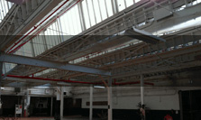
- Representative View(s)Click on image to view full file
-
Photographer
n/a
Photography Date
n/a