Mill Record Waterford
RETURN TO ‘FIND MILLS’Disclaimer: Content for these properties was compiled in 2014-2017 from a variety of sources and is subject to change. Updates are occasionally made under Property Information, however the Connecticut Trust for Historic Preservation (dba Preservation Connecticut) makes no representation or warranty that the information is complete or up-to-date.
- Complex Name (Common)
- Jordan Woolen Mill
- Complex Name (Historic)
-
- Jordan Woolen Mill
- Address or Location
- 6 Mill Lane, Waterford
- County
- New London
- Historic Designation
- Associated Mill Community
- n/a

- Historic Information
Companies Associated w/Complex
- Jordan Woolen Mill c.1920-
- grist mill 18thc - 1905
Use (Historic)
Largest Documented Workforce
n/a
Historic Narrative
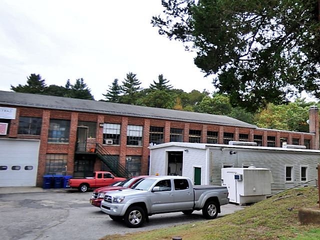
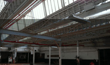
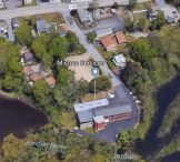
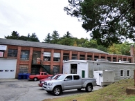
Located in the Jordan Village Historic District; from National Register narrative: 'One of the most historic sites in the village is the former 18th century grist mill, which was apparently in continuous operation from 1731 until destroyed by fire in 1905, at the falls of Jordan Brook where it enters Jordan Cove. An ashlar mill dam, elements of the head and tail race, and the random ashlar retaining/foundation wall on the north side of the cove survive. The frame grist mill was located at the end of a short street south of Rope Ferry Road, and the site has been redeveloped with a 2-story brick woolen mill built in 1920 of brick pier construction. The mill is well-preserved and is currently used for specialty manufacturing. The mill dam is crossed by a modern, pedestrian pony-truss bridge that connects the grist mill site with a small park of approximately 5 acres.'
- Architectural Information
- Property Information
-
Specific Location
A 1.46 acre parcel at south end of Mill Lane off Rope Ferry Road, west of the intersection with Rte. 213
Adjacent To
Exterior Visible from Public Road?
No
Parcel ID / Assessor Record Link
- 138/ / 4588 / Link →
Acreage
1.46
Use (Present)
- Sources
-
Form Completed By
n/a
Date
n/a
Bibliography
n/a
- Representative View(s)Click on image to view full file
-
Photographer
n/a
Photography Date
n/a