Mill Record Torrington
RETURN TO ‘FIND MILLS’Disclaimer: Content for these properties was compiled in 2014-2017 from a variety of sources and is subject to change. Updates are occasionally made under Property Information, however the Connecticut Trust for Historic Preservation (dba Preservation Connecticut) makes no representation or warranty that the information is complete or up-to-date.
- Complex Name (Common)
- Torrington Co., Wire Mill
- Complex Name (Historic)
-
- Torrington Co., Wire Mill
- Address or Location
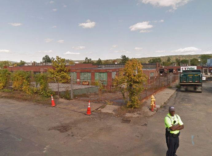
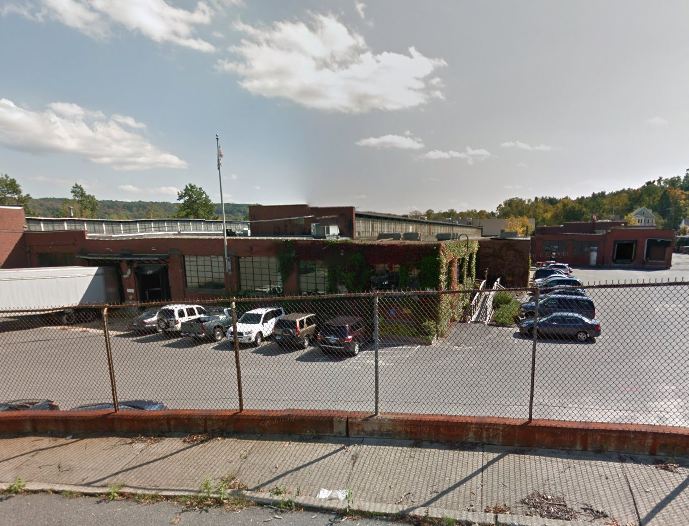
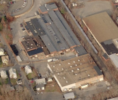
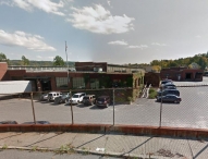
- 30 Irene Street and 62 Broad Street, Torrington
- County
- Litchfield
- Historic Designation
- n/a
- Associated Mill Community
- n/a

- Historic Information
Companies Associated w/Complex
- Torrington Co. 1957-1968
- Torrington Co. Division of Ingersoll-Rand Corp. 1968-1985
- White Flower Farm 1985-present
Use (Historic)
Largest Documented Workforce
n/a
Historic Narrative
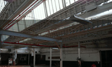
The Torrington Company of Maine was established in 1898 as a holding company by executives associated with Kidder, Peabody and Co. of Boston Mass. Its holdings included the Excelsior Needle Company (later Torrington Co. Excelsior Needle Division) and Standard Spoke and Nipple Company (later Torrington Co. Standard Plant) in Torrington. The Torrington Company was reorganized as the Torrington Company of Connecticut in 1917, and was bought in 1968 by the Ingersoll-Rand Corporation. This Broad Street facility was built in two stages, in 1957 and c.1962. In 1957, needle roller production was consolidated here, opening up operations space at the Standard Plant (see resource 2734). The wire mill was added c.1962 with the aim of reducing raw material costs by drawing down rods to the needed sizes in house. The earlier part of the complex was sold in 1985 to White Flower Farms for the shipping operations.
- Architectural Information
Number of Existing Buildings
n/a
Dates of Construction
1957, c.1962
Architect
n/a
Builder
n/a
Building Type
Architectural Description
n/a
Exterior Material(s)
Structural System(s)
n/a
Roof Form
Roof Material
n/a
Power Source
Condition
n/a
Condition Notes
n/a
- Property Information
-
Specific Location
Two legal parcels totaling 11 acres at the end of Broad Street and west of the railroad bed.
Adjacent To
Exterior Visible from Public Road?
Yes
Parcel ID / Assessor Record Link
Acreage
6.14; 4.85
Use (Present)
- Sources
- Representative View(s)Click on image to view full file
-

Photographer
n/a
Photography Date
n/a